Wednesday, November 24, 2010
Lab10
1. Would you have more problems with feature generalization and omission in large or small scale maps? Why?
You would have more complications with feature generalization and omission with small scale maps due to surface errors that arise.
2. What is snapping in the context of digitizing? Why is snapping important (i.e. what does it help avoid)?
Snapping in the context of digitizin is putting two or more nodes with a given distance between another to become a single node, and it is important in order to avoid over and under shots.
3. What is COGO and how does it relate to coordinate surveying?
COGO is coordinate geometry which is a common output from survey measurement spaital data that consists of a starting point with a list of directions and distances to subsequent stations.
Q: What is the feature class type (point, line or poly) for Springs?Point
Monday, November 8, 2010
Lab9b
1. How many counties does the State of Iowa contain? (1 pt)
99 counties
2. Which county in Georgia contains the largest number of people, as of the year 2001? (1 pt)
Fulton
3. How many cities, with populations between 10,000 and 49,000, are located within the State of Washington? (1 pt)
32 cities
4. How many miles long are all of the interstates in Los Angeles County? (1 pt)
4105 miles
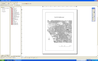
5. Simplify the UrbanBoundaries feature class so that only the urban areas of Los Angeles County are visible (Hint: you must use one of the overlay functions). Create a new feature class and save it into the LosAngeles dataset using the name LA_Urban. Include a screenshot of this new layer with your assignment. (2 pts)
6. How many acres of urban area lie within Los Angeles County, based upon your results from question #5? ( 1 pt)
1441652.796
7. How many zip codes have their centroid in Los Angeles County? (1 pt)
522
8. Create a layer displaying the provinces of Canada using the data provided to you in the Canada feature dataset. Save this new layer under the Canada feature dataset using the name Provinces. Include a screenshot of this new layer with your assignment. (2 pts)
9. Which Native American Indian Reservations lie within 75 miles of the City of Thurso in Canada? (1 pt)
Kitigan Zibi Indian Reserve, Doncaster Indian Reserve 17, Kanesatake Indian Reserve 16, Akwesane Indian Reserve
Wednesday, November 3, 2010
Lab9.a
I.
2. What are the two types of Algebra used in queries? Give an example of each.
Less than < Greater than > Equal to = Not equal to <>
3. What are the different types of spatial selection operations?
By Attributes-Set Algebra, Boolean Algebra
By Spatial characteristics- Adjacency, Containment
4. Is there a feature dataset in the geodatabase? Yes, Los Angeles feature dataset.
5. What features classes are present? PtDumeQuad, Vegetation, Wetlands, Wetlands_Project.
III. Exercise 1: Prepare (simplify) a vegetation layer for the Los Angeles region for further spatial analysis.
6. How many features (records) exist in the Vegetation feature class in the Lab9aData.mdb geodatabase? Number of records: 10896
7. How many features (records) exist in the new VegCov feature class after running the dissolve operation? 9 records
8. How many features (records) exist in the new “VegCov_Clip” feature class? 1450 records
IV. Exercise 2: Generate a layer of Riverine wetlands that fall in the Point Dume quad.
§ Use the Select By Location tool to determine how many total wetlands have their centroid in the Point Dume quad.
9. How many wetland features (records) were selected? 404 records were selected
10. How many features (records) were selected? 123 records
§ Export only these selected Riverine wetlands into a new shapefile named “Riverine_FirstInitialLastName”. Make sure to place this new shapefile inside your working directory for Lab 9a on C:/. Ex. Riverine_rmaas.
§ Capture a screenshot (Alt PrtScr) of your final Riverine layer and paste it into this document.
Subscribe to:
Comments (Atom)


